

Mapping Angin Nauli
A cartographic collection by our team
This atlas brings together four thematic maps built from field surveys, satellite imagery, and geospatial analysis. Together, they offer a layered view of Angin Nauli's terrain, land cover, living landscape, and landslide risk.
Browse the optimized previews for a quick overview, then open the original PDF when you need to inspect the full legend, coordinate grid, scale, or fine map details.
Map 01
Slope Analysis
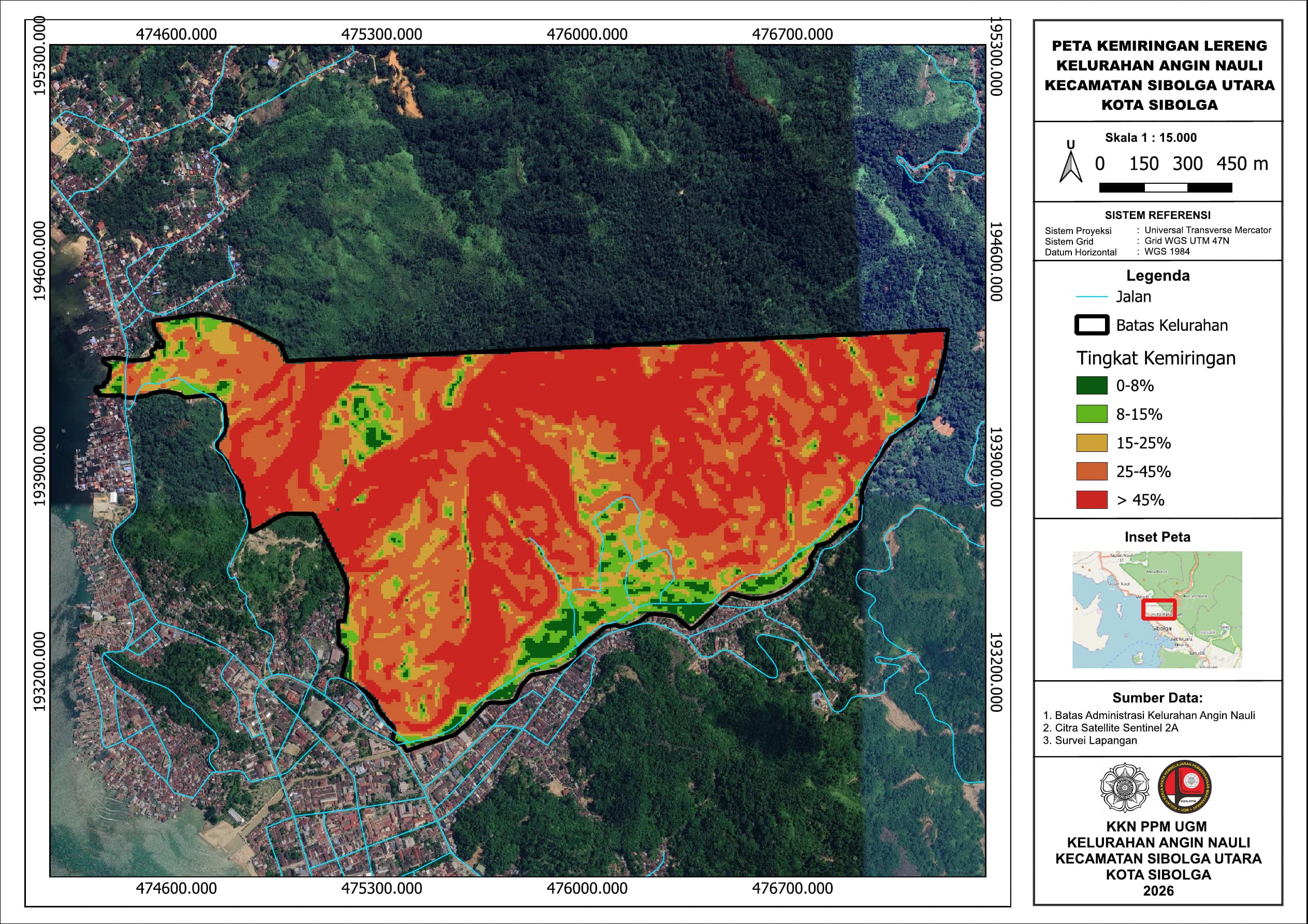
A terrain classification showing slope gradients from 0-8% through areas steeper than 45%. The map makes the sharp transition from the lower settled edge to Angin Nauli's steep interior immediately visible.
View full map (PDF)Map 02
Land Use
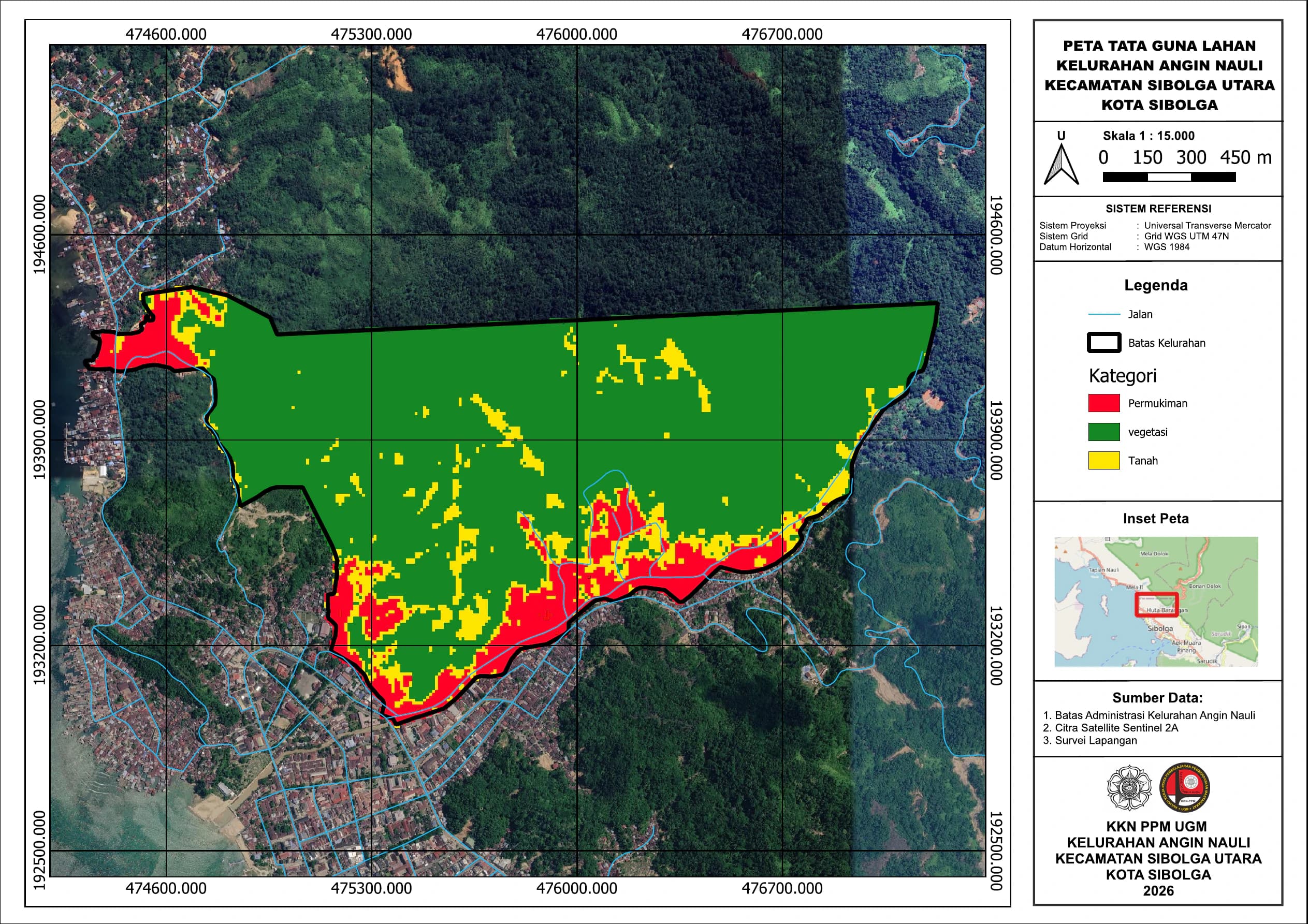
A land-use interpretation of Angin Nauli grouped into settlement, vegetation, and open soil. It highlights the dense vegetated interior and the pattern of developed areas along the southern and western edges.
View full map (PDF)Map 03
Flora Distribution
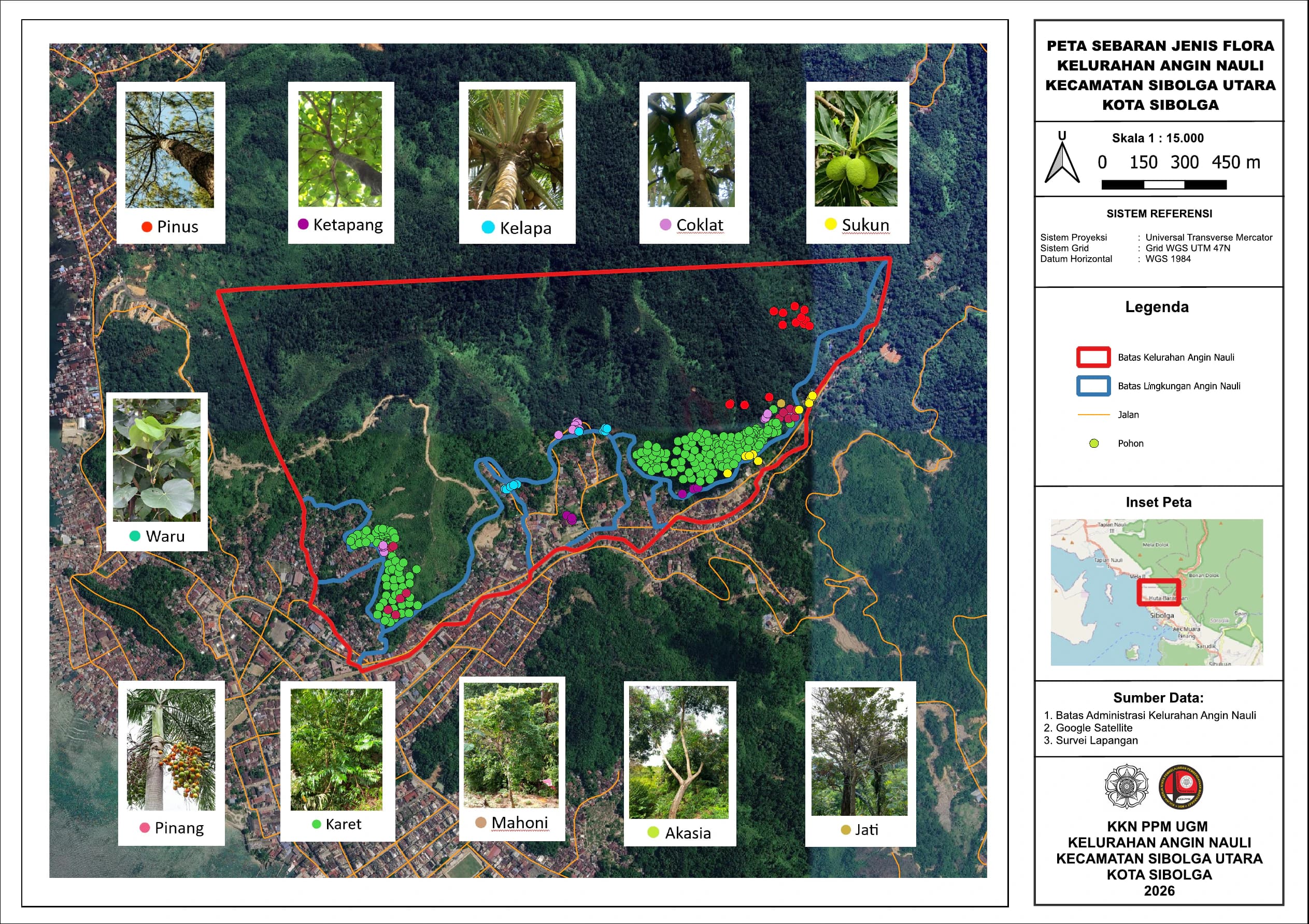
A field inventory plotting the observed distribution of eleven flora types, including pine, ketapang, coconut, cacao, breadfruit, waru, areca palm, rubber, mahogany, acacia, and teak across Angin Nauli.
View full map (PDF)Map 04
Landslide Points
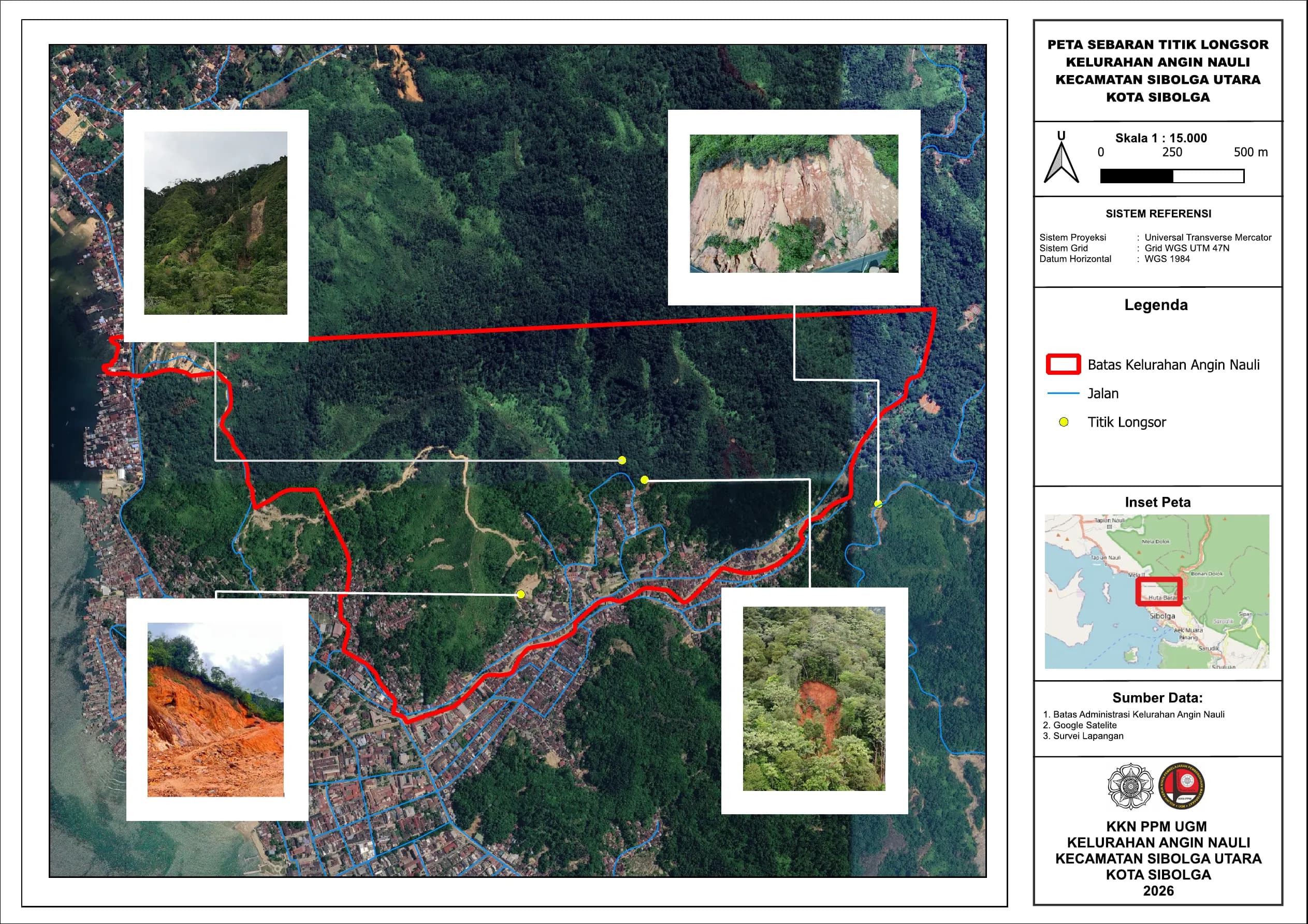
A field-survey map showing four documented landslide points across Angin Nauli, with photographs and locations over satellite imagery. It connects the mapped terrain to places where slope movement has been recorded.
View full map (PDF)